
Remember me


A snowstorm and harsh winter weather have impacted at least 177 million people across the US, with several Northeastern and Mid-Atlantic states under watches or warnings for ice and snow. More than 200 million were under cold weather advisories or warnings.
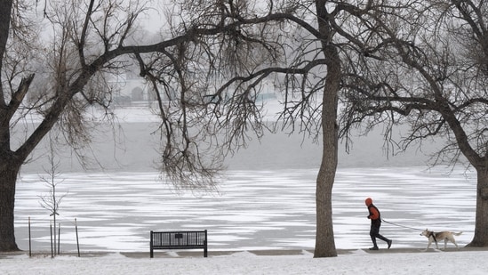
") A runner and his dog circle a frozen Prospect Lake in Colorado Springs, Colo., Friday (AP)
A runner and his dog circle a frozen Prospect Lake in Colorado Springs, Colo., Friday (AP)As a winter system lasts through the weekend, forecasters are again pointing to the polar vortex, a large-scale atmospheric pattern that can determine how far south Arctic cold is able to travel.
What the polar vortex actually isThe polar vortex is a vast pool of frigid air that circulates high above the Arctic, spinning in the upper atmosphere. It exists because temperatures near the North Pole are far colder than those farther south, creating powerful winds that rotate around the region. Contrary to popular belief, the vortex is not a storm and does not suddenly appear during winter.
Why it matters in winterDuring colder months, the polar vortex typically strengthens and stays well-contained near the Arctic, keeping the most extreme cold locked far north. Problems arise when that circulation weakens or becomes distorted. When that happens, Arctic air can spill southward into the US, setting the stage for sharp temperature drops, extended cold spells, and a higher likelihood of snow.
This is why the term “polar vortex” often surfaces in forecasts tied to major winter weather events, particularly across the Northeast and Mid-Atlantic.
What it doesn’t doAccording to the National Weather Service, the polar vortex is frequently misunderstood. It is not a single blast of cold air, nor is it responsible for every chilly winter day. Day-to-day weather is still shaped by cold fronts, storm systems, and regional patterns. Meteorologists typically reference the polar vortex only when large-scale atmospheric shifts are underway, not during routine cold snaps.
Why meteorologists are watching nowChanges in the polar vortex can influence the jet stream, the fast-moving band of air that guides storms across North America. When the jet stream becomes more wavy, it can dip farther south, allowing cold Arctic air to move into the eastern US.
What remains uncertainWhile scientists can detect disruptions in the polar vortex days or even weeks ahead of time, the exact impacts at ground level, including snowfall totals and the duration of cold, depend on several variables. Those details typically come into focus closer to a storm’s arrival.