
Remember me
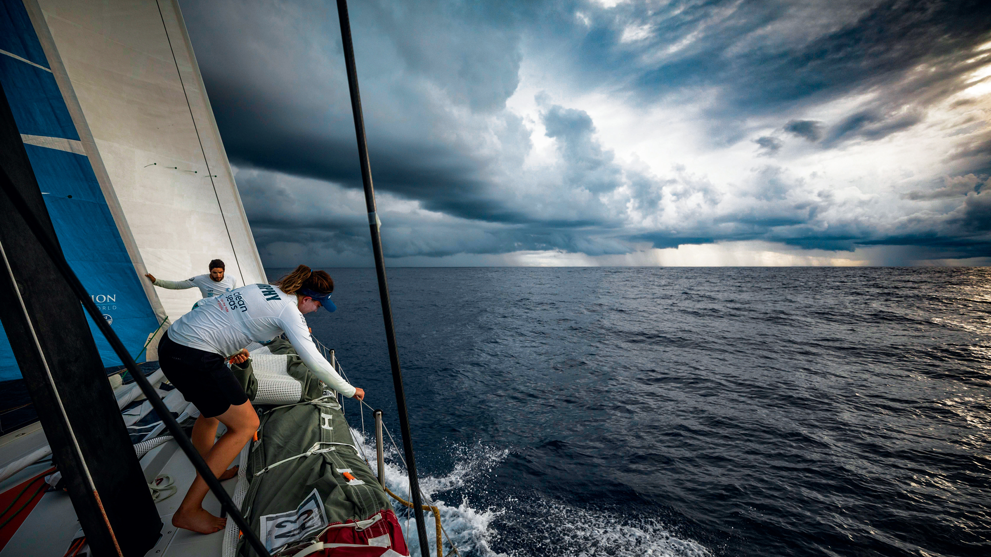


A squall can add to, subtract from, or totally reverse the wind. Learning to map it by any means is the key to staying upright, says Simon Rowell
Squalls are self-contained convective systems, often confined to less than a mile or so in diameter, but they can occur in clumps of several hundred miles in spread. They are common in the tropics, and the warmer the water is, the more active they will be.
At sea, the first thing to work out is where they will move in relation to you, and during the day the ‘Mark 1 eyeball’ is the best method to use. Simply treat any worrying squall cloud as if it was an approaching ship – if it’s on a reasonably steady bearing and doesn’t seem to be going to port or starboard of you, then it’ll pass over you. Likewise, if it seems to be opening its bearing to pass ahead or astern, then that is what it will do.
Radar watchAt night a good radar watch should be kept every quarter of an hour or so. Of course, a visual watch is still effective at night – as an approaching squall will start to block out the otherwise bright stars.
If you do pick up a squall on radar, put an Electronic Bearing Line (an EBL) on it and monitor it – if the squall marches straight down the line it’s going to pass over you. At this point you may want to change course or reduce sail – or both!
Squalls are convective systems, driven by the strong solar radiation in the tropics and sub-tropics, often coming in with fronts through the English Channel. The worst squalls for sailing are the ones that grow in front and over the boat, and seem to sit there with no wind in the middle of them, leaving you just bobbing around until the squall slowly moves off. These are also the ones that stay during the night as well, which seems to go against the fact that convection is kicked off by solar radiation warming the surface.
Let’s look at a simple squall to start with. If there is no gradient wind, a convective system will effectively kill itself off (Figure 1, below). Warm air will rise to start with and as it is over the ocean it will be moist. As this rises it cools, and the water will start to condense to form clouds. The cloud droplets will increase in size until their weight exceeds the upward force of the updraught and they will fall as rain.
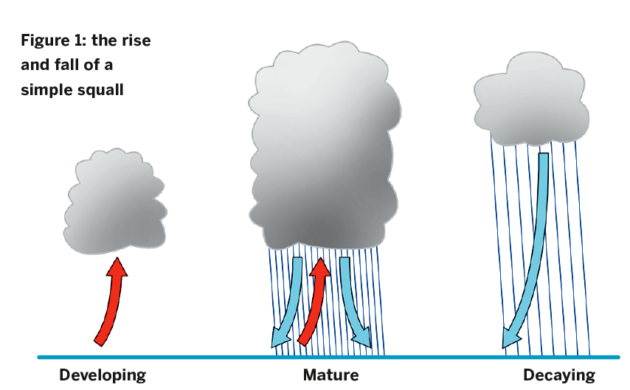
As the rising air reaches the top of the squall cloud it will have been cooled more than the surrounding air due to the energy taken out by the water condensing and so this air will fall down the outside of the cloud. Some will also fall inside it as cold downdraughts, which is what you often feel just before a squall actually passes over you.
Additionally, the raindrops themselves will drag air down with them, causing further downdraughts inside the cloud. This eventually counteracts the updraught of warm air, and the squall just seems to rain itself out, with the cloud base getting higher and higher until it disappears.
However, if there’s a steady wind blowing this will give wind shear, the phenomenon whereby surface friction slows the surface wind down and it increases in speed with altitude until the steady gradient wind speed is reached. This is the situation which will give rise to self-sustaining squalls. The wind shear makes the whole convective system lean over, which then makes the precipitation and therefore the cold downdraughts fall away from the warm thermal updraughts (Figure 2). As these cold downdraughts hit the surface, they spread out in all directions, including against the regional wind.
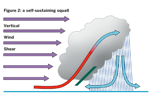
Because the cold downdraughts are denser than the surface air they’ll force this warmer air to rise (shown by the green line) and this process will carry on at night like a miniature front – the system is effectively generating its own lifting mechanism. Also, if the velocity of the downdraught as it spreads out over the surface is the same as that of the regional wind, the system will effectively stay in the same place – and if that’s directly above your boat, you have no choice but to bob around until it slowly moves off.
The squall will also have a localised effect on the general gradient wind (Figure 3). If the squall is directly coming at you, the gusts will add to the gradient wind, increasing the wind you feel. If it passes ahead of you the gusts will act against the gradient wind, decreasing or sometimes even reversing it. If the squall passes to the side of you then, depending on the spatial relationship, it will back or veer the wind – it pushes the local surface wind away from the cloud.

Deep squall clouds are occasionally a source of hail. Hail occurs all over the world, whatever temperature the air at the surface is. Hail is made up of rain drops that have been kept up above the freezing height by strong updraughts.
Strong updraughts are generated in deep squall clouds and tropical depressions in the tropics, and in tall cumulonimbus clouds along cold fronts in the extra-tropical regions. Because the cloud is tall, a significant proportion of it will be above the freezing level, and any tiny droplets will actually be ice crystals or supercooled droplets. These will be bounced around in the strong updraughts and will accrete more and more ice, becoming larger and therefore heavier.
After a while the weight of the larger ice crystal will become stronger than the upwards force provided by the updraughts and it will fall. If it is large enough then not all of it will melt by the time it gets to the surface, and the unmelted bit is what we see as a hailstone.
 If you enjoyed this….
Yachting World is the world’s leading magazine for bluewater cruisers and offshore sailors. Every month we have inspirational adventures and practical features to help you realise your sailing dreams.
Build your knowledge with a subscription delivered to your door. See our latest offers and save at least 30% off the cover price.Note: We may earn a commission when you buy through links on our site, at no extra cost to you. This doesn’t affect our editorial independence.
Comments (0)