
Remember me


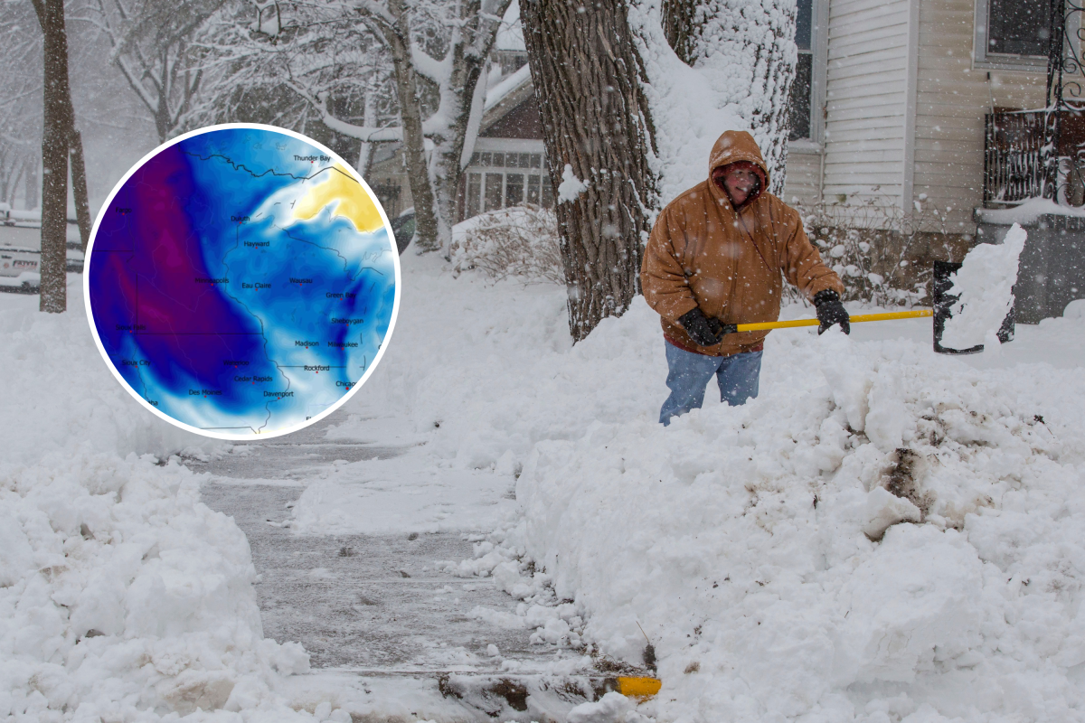


A bout of harsh winter weather driven by lake‑effect snow is bringing hazardous conditions to three states this weekend, prompting the National Weather Service (NWS) to issue winter storm warnings.
The latest advisories, impacting Wisconsin, Michigan, and Alaska, warn of heavy snow, sharp drops in visibility, and dangerous travel conditions expected to last through Saturday.
The warnings—some issued in the early hours of Saturday morning—outline snowfall totals as high as 10 inches in the hardest‑hit areas, with the NWS urging residents to avoid travel whenever possible.
Forecasters say conditions will vary by region, but slippery roads, blowing snow, and rapid changes in visibility could make driving treacherous throughout the day. The impacted areas are as follows:
 Wisconsin
 Winter storm warnings remain in effect in northern Wisconsin until 6 p.m. CST this evening, following their early‑morning issuance at 1:40 a.m. CST.
Bayfield and Douglas Counties are expecting up to 4 additional inches of snow, especially across northern areas, including the Red Cliff tribal lands and the Apostle Islands National Lakeshore.
Roads will be slippery, and the NWS is strongly discouraging travel, particularly along State Route 13 on the South Shore, where conditions may deteriorate quickly, and possible power outages are a concern.
In neighboring Iron County, heavy lake‑effect snow is expected to continue through the evening. Most areas will see up to 2 inches, but the northern part of the county may receive 3 to 6 inches.
Visibility may fall below a quarter mile due to falling and blowing snow, creating dangerous travel conditions.
The NWS is urging drivers to delay travel if they can and to bring extra food, water and a flashlight if they must be on the road.
MichiganA winter storm warning issued at 1:38 a.m. EST remains in effect for Gogebic and Ontonagon Counties until 7 p.m. EST / 6 p.m. CST this evening.
Lake‑effect snow, heavy at times, will continue throughout the day, with 1 to 6 inches expected. The highest totals are likely in the higher terrain near Lake Superior, from Ironwood to areas just south and uphill from Ontonagon.
The NWS warns that travel could become “very difficult” as snow accumulates and visibility drops. Drivers are advised to avoid travel when possible and to carry emergency supplies if they must head out.
AlaskaIn Alaska, winter storm warnings issued at 8:57 p.m. AKST Friday remain active until 3 a.m. AKST Saturday, covering the Lower Koyukuk Valley, Upper Kobuk Valleys, and the South Slopes of the Western Brooks Range.
The region is seeing 5 to 10 inches of snow along with wind gusts reaching 40 mph.
Blowing and drifting snow may drive visibility below a quarter mile, especially above 1,000 feet.
The NWS says travel could be “very difficult” and is advising residents to delay trips if they can. Those who must travel should bring extra food, water and a flashlight.
What a Winter Storm Warning MeansA winter storm warning is issued by the NWS when heavy snow, strong winds or dangerous winter conditions are either happening or expected very soon.
It signals that travel could become hazardous, with icy roads, reduced visibility and rapidly worsening weather.
When a warning is in effect, the NWS urges people to stay off the roads if possible and to be prepared for conditions that may disrupt driving, power and basic services.