Temperatures are set to fall overnight to a chilly 0C, before a washout weekend with isolated thunderstorms and spot flooding both on the cards.
Overall, Met Éireann forecasters have said it will turn wet and breezy for a time on Sunday, with some generally mixed weather over the weekend and coming days.
Friday will see showers turn heavy or thundery with hail possible in parts alongside falls of sleet, with temperatures dropping to 0C.
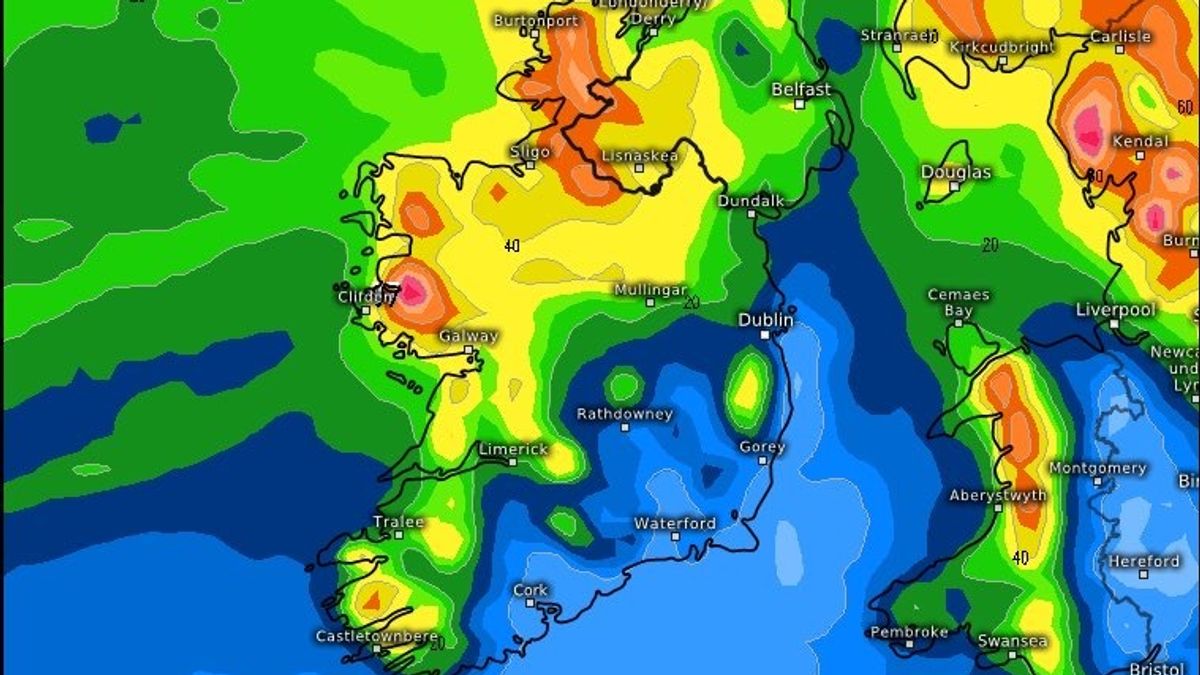
Saturday will kick off with showers, the heaviest and most frequent in the north and west with chances of isolated thunderstorms, hail and sleet on high ground. This will clear overnight before a wet and breezy Sunday morning. Winds will reach gale force at times for western and northern coasts and the rain will be heavy with some spot flooding possible.
Alan O'Reilly from Carlow Weather said that while rainfall amounts up to next Friday vary across models, the southeast is set to be the driest. He wrote: “Rainfall amounts for next seven day varies across the models but the southeast forecast to be driest spot.”
Here is Met Éireann’s weather forecast for the coming days:
Friday
Cloud with any lingering rain and drizzle in the south and east, along with some mist patches, will clear this morning as sunny spells extend from the north and west. Scattered showers will develop from later this morning, some of which may turn heavy in the afternoon. Highest temperatures of 8C to 11C with westerly winds increasing moderate to fresh for the afternoon, strong for western and northwestern coasts but easing in the evening.
Clear spells and scattered showers tonight, most frequent in the north and west. Some of the showers will be heavy or thundery with hail possible. There could also be some falls of sleet, mainly on high ground. Lowest temperatures of 1C to 5C generally, falling to 0C locally, in mostly moderate, occasionally fresh westerly winds, strong along Atlantic coasts.
Saturday
Sunny spells and showers tomorrow morning, heaviest and most frequent in the north and west with chances of isolated thunderstorms, hail and sleet on high ground. The showers will ease during the afternoon, becoming isolated for the evening. Highest temperatures of 7C to 10C in moderate to fresh and gusty west to northwest winds, strong for western and northern coasts, easing mostly light through the evening.
Largely dry and clear at first with just isolated showers on Saturday night. Cloud will build from the west with rain following into the northwest towards morning. Lowest temperatures of 2C to 6C. Light to moderate southwesterly winds will strengthen towards morning.
Sunday
A wet and breezy morning as rain extends southeastwards along with fresh to strong and gusty southwest to west winds, reaching near gale force at times for western and northern coasts. The rain will be heavy at times, especially for the north and west, with some spot flooding possible. The rain will clear southwards during the afternoon as sunny spells follow along with some showers, mainly for the north. Winds will moderate during the evening. Highest temperatures of 9C to 13C.
Largely dry and clear at first with just some showers in the north on Sunday night. Cloud will build from the west through the night. Lowest temperatures of 6C to 10C or 11C, coolest in the northeast, in mostly moderate westerly winds.
Want to see more of the stories you love from the Irish Mirror? Making us your preferred source on Google means you’ll get more of our exclusives, top stories and must-read content straight away. To add Irish Mirror as a preferred source, simply click here.


Comments (0)