Met Eireann has been accused by members of the public of "dropping the ball" over how it managed Storm Chandra.
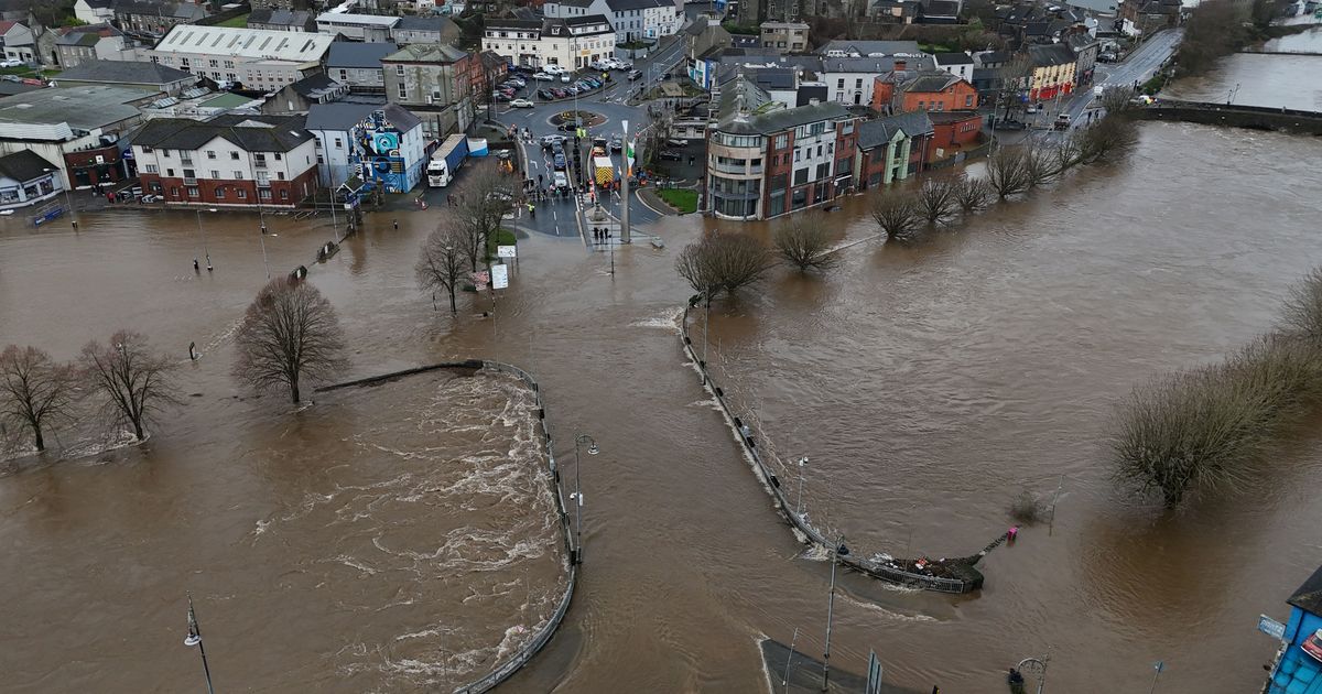
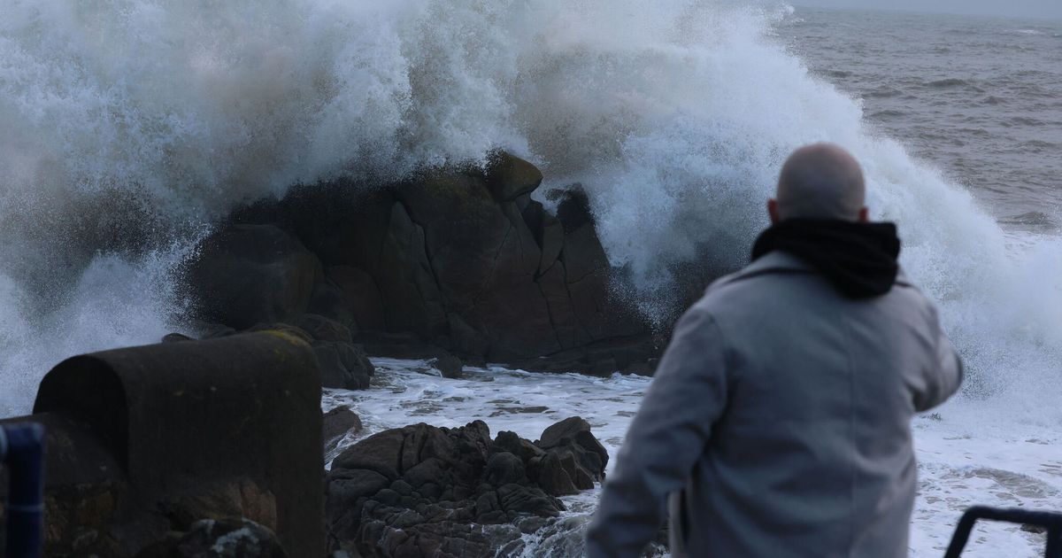
There was widespread anger and frustration across Ireland on Tuesday when hundreds of thousands of people woke up to severe flooding and strong winds.
Met Eireann issued several Status Yellow warnings and updates ahead of the storm however some alerts were issued at the the same time they became active.
There was a Status Yellow warning of rain issued for counties Carlow; Kilkenny; Louth; Wexford; Wicklow and Waterford at 11:08am on Tuesday - this weather warning was active between 11:08am and 11pm on Tuesday. There was also a Status Yellow warning of wind issued for all of Ireland at 11:08am - this too became active at 11:08am.
"Has there been a redefinition of what “weather forecasting” now means," asked one angry member of the public referring to the lack of time between warnings issued and when they were due to become active.
The Met Office in the United Kingdom issued Amber alerts for counties Antrim; Down and Derry. The equal to the Amber alert in the Republic of Ireland is Status Orange but there were no such warnings issued by Met Eireann ahead of Storm Chandra.
Many members of the public were shocked that Met Eireann maintained the alert level at yellow across Ireland.
"It's not good enough," said one man. " Met Eireann have completely dropped the ball with Storm Chandra.
"Absolutely ridiculous that the national weather service failed yet again, people need proper advance warnings!"
Another person said: "No status yellow in Dublin for rain, was only for wind. Disgraceful decision by Met Eireann. Wexford, Wicklow, Meath, and Louth all had rainfall warnings."
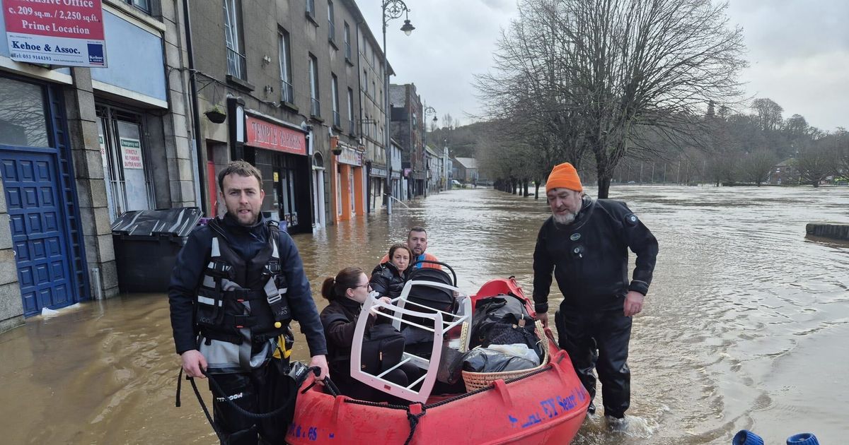
There were reports of people being rescued from their homes in Co. Wexford. Businesses and homes were also gutted when a record amount of rain fell within a few hours.
A Met Eireann spokesperson defended the way it compiled and communicated the weather warnings, when contacted by The Irish Mirror on Tuesday.
"Storm Chandra was named yesterday, and it was forecast to bring heavy rain and strong winds to the country. Met Éireann issued a series of rain and wind warnings based on the latest model guidance.
"Met Éireann delivered an update on the expected conditions for Tuesday at a technical briefing of the NECG on Monday afternoon. At this meeting Met Éireann indicated that there would be a high likelihood of river flooding as well as surface flooding in parts of Leinster and Munster, due to the expected rainfall and the antecedent conditions."
The spokesperson added: "The impacts and risks were communicated to the public through our website, social media posts, and media interviews. The track of Storm Chandra shifted late on Monday resulting in the extension of the wind warnings to the rest of the country.
"Met Éireann is currently in the process of developing and upgrading its Weather Warning System. Key enhancements include: Technical upgrades to improve system resilience and performance as well as a capability to issue sub-county warnings for more localised events.
"Met Éireann is actively engaging with Local Authorities to identify their requirements for the Weather Warning System and plan for changes in the context of the Framework for Major Emergency Management. The technical element of the upgrade project has commenced. An associated educational and communication campaign will be launched to ensure stakeholders, and the public understand how to interpret and respond to the updated warning system."
Subscribe to our newsletter for the latest news from the Irish Mirror direct to your inbox: Sign up here.