A new bout of cold weather cannot be ruled out in the coming weeks, but chances remain low and for now, we can continue to experience rainy and unsettled conditions
The weather over the coming days is set to take a cooler turn when compared to the milder start we had to January 2026.
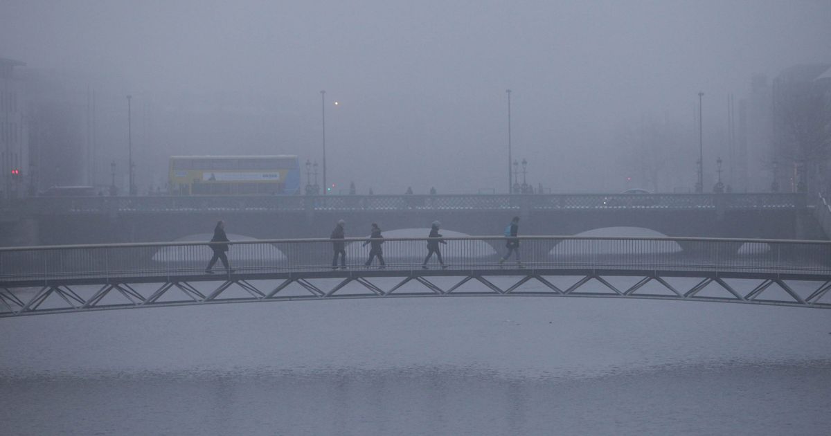
Met Eireann said that ice, frost and freezing fog is on the way. The national meteorological service added that "cooler days and chilly nights" will arrive, and further outbreaks of scattered showers and persistent widespread fog are predicted.
This comes as mixed reports regarding a 2018 style "Beast from the East" snowy spell demonstrate the difficulties and changeability of long range weather forecasting, as while we are unlikely to see such a quantity of snow, it is never an impossibility. Long range forecasting is notoriously subject to change and a cautious approach is always advised.
Cathal Nolan of Ireland's Weather Channel shared his view of the forecasts of a second "Beast from the East."
"We’ve been sent screenshots, private messages and have taken calls from dozens of individuals concerned about the prospects of a “beast from the east” style period of weather being “forecast” by certain media groups over the last few days.
"We’ve looked at all the available data, crunched our own figures, run our own models, and something a little a kin to the John Lennon quote “the more I see, the less I know” springs to mind… at least when it comes to making a definitive prediction.
"Yes, many of the trusted models this evening indicate the likely development of a blocking high pressure system across Scandinavia and Western Russia, with easterly winds pushing westwards through Europe, but just how far remains uncertain.
"The Atlantic, a typically formidable opponent, is forecast to become somewhat more subdued by the end of next week, at which point could allow for a more substantial push from the colder easterly winds and much colder air over Eastern Europe.
"Experience teaches us to be cautious in certain scenarios, with various models experiencing difficulties with accurately predicting such patterns. This cautious approach is being touted by other meteorologists, experts and organisations, which for now is prudent.
"For now we remain on standby. We need greater clarity from the weather models and until we receive that clarity any such predictions of impending crippling cold are to be taken with a substantial pinch of salt. For now, our weather remains mixed and mobile.
"Could we see a repeat of conditions experienced in 2018? It’s not entirely out of the question, but, for now it remains just that, one of many possibilities and outcomes. Don’t go stocking up on bread, milk and toilet paper just yet."
Met Eireann said that there is a "signal for cool or cold weather to return" but there is "uncertainty in the forecast. Current indications suggest unsettled conditions will continue as a mobile Atlantic regime remains in charge."
Here is the forecast for the rest of the week, with some cold conditions on the way:
Friday
Mist and fog will clear early this morning leaving a bright day for most. Scattered showers will mostly affect parts of the south and east today, possibly turning heavy and thundery at times with the slight chance of hail. Highest temperatures of 4 to 9 degrees in light to moderate southeasterly or variable winds.
Tonight will be dry for most with scattered showers mostly keeping to coastal fringes. Mist and fog will develop overnight becoming widespread by morning under mostly calm conditions. Frost and ice will form under any clear skies with lowest temperatures of -2 to 3 degrees, mildest in the northeast.
Saturday
Saturday will be a similar set up with mist and fog lingering for a time. It'll a generally dry but cloudy day. Isolated showers will be mostly confined to the coasts at first but will gradually feed in over parts of the east and northeast through the afternoon. Highest temperatures of 4 to 8 degrees in light southeasterly or cyclonic variable winds.
Mostly dry and cloudy overnight with the exception of coastal showers. Similar to the previous night, widespread fog will develop in places along with frost patches under any clear skies. Lowest temperatures of -2 to +3 degrees in near calm conditions.
Sunday
Mist and fog will linger in places, but it will remain generally dry for the earlier half of the day, with brighter breaks further east. Through the afternoon, rain and drizzle will feed in over western counties and gradually clear eastwards overnight and into Monday morning. Highest temperatures of 6 to 9 degrees in light to moderate southeasterly winds. As rain continues to move in overnight temperatures will be relatively milder with lows of 2 to 6 degrees in moderate southeast winds.
Join our Dublin Live breaking news service on WhatsApp. Click this link to receive your daily dose of Dublin Live content. We also treat our community members to special offers, promotions, and adverts from us and our partners. If you don’t like our community, you can check out any time you like. If you’re curious, you can read our Privacy Notice.
For all the latest news from Dublin and surrounding areas visit our homepage.


Comments (0)